Decimal Degrees & What They Mean

Decimal Degrees are a way to express latitude and longitude coordinates. They operate as a convenient, simplified alternative to Degrees Minutes Seconds (DMS) notation and are helpful for calculations and digital systems. Decimal degrees look something like this: 40.063766, -82.346497
Whereas, in DMS notation the same coordinates look like this: 40° 3' 49.5576", - 82° 20' 47.3892" with a degree symbol (°), decimal minutes (3'), and seconds (49.5576").
At Smarty, our products utilize geocodes formatted as decimal degrees and deliver a 5 or 6-decimal geocode. This coordinate marks the location of an address or area depending on which product you purchase.
You can test out Smarty's products for free below or continue reading to learn about accuracy and precision.
| US Rooftop Geocoding | International Geocoding | US Reverse Geocoding | US Master Address List |
|---|---|---|---|
So, what will we cover:
- How Many Decimal Degree Places Should a Geocode Have?
- Decimal Degree Resolution by Number of Digits
- Geocoding Resolution Levels
- Geocoding Accuracy & Precision
- Examples of High-Accuracy Geocoding Use Cases
- Conclusion
How Many Decimal Degree Places Should A Geocode Have?
A common question surrounding decimal degrees is if 5 or 6 decimal places geocode provides enough precision. Adam, our resident geocode expert, explains, "..six decimal places is the right precision to be accurate but not overly specific." But what does overly specific mean?
To illustrate, let's begin with a no decimal degree geocode: 40, -82
Without decimal degrees, the earth divides into 181 possible latitude values (including 0) and 361 longitude values (including 0) that multiply into 65,341 possible coordinate combinations. The average area of these 65,341 parts is 3011.38 mi² (7806.73 km²) per geocode.
Adding one decimal degree place (e.g., 40.1, -82.1) increases the possible values to 1810 and 3610, respectively. Combined, you can pinpoint any of ~6.5 million points on Earth with a much smaller represented average area of 30.37 mi² (78.69 km²) per geocode. Each additional decimal degree place provides 100x resolution.
When obtaining geocodes from a geocoding service, the quantity of digits after the decimal in a geocode rarely matters beyond 5 or 6 digits. For example, Google Maps delivers geocodes up to 14 decimal degree places. e.g., 40.04935857051474, -82.35438843514034, translating to an area of about 36 nanometers² (about 1/4th of a single HIV virus).
The more decimal degree digits, the less value they provide. Granted, this can depend on your use case as we see below:
| Decimal Degrees | Representative Geocode in Decimal Degrees | Total Geocodes | Avg. Area Represented | Example |
| 0 | 40, -82 | ~65 thousand |
3011.38 mi² (7806.73 km²) |
Slightly larger than the US state of Delaware |
| 1 | 40.0, -82.3 | ~6.5 million |
30.37 mi² (78.69 km²) |
A little smaller than Paris, France |
| 2 | 40.06, -82.34 | ~648 million |
0.304 mi² (0.78 km²) |
About the size of The Forbidden City |
| 3 | 40.063, -82.346 | ~65 billion |
84732.10 ft² (7871.87 m²) |
About the size of a soccer/football field |
| 4 | 40.0637, -82.3464 | ~6.5 trillion |
847.33 ft² (78.72 m²) |
About the size of a racquetball court |
| 5 | 40.06376, -82.34649 | ~648 trillion |
8.47 ft² (0.79 m²) |
The size of a small desk |
| 6 | 40.063766, -82.346497 | ~65 quadrillion |
12.20 in² (78.72 cm²) |
A little bigger than a playing card |
| 7 | 40.0637668, -82.3464975 | ~6.5 quintillion | 78.72 mm² | About the size of a nailhead |
| 8 | 40.06376686, -82.34649753 | ~648 quintillion | 0.79 mm² | About the size of a ballpoint pen tip |
| 9 | 40.063766867, -82.346497530 | ~65 sextillion | 7872 µm² | About the size of a tardigrade |
| 10 | 40.0637668675, -82.3464975309 | ~6.5 septillion | 79 µm² | About the size of a grain of very fine sand |
If you think you need 7 digits to indicate a spot on earth, you're tracking items the size of a nailhead and will have to update your geocodes every 6 months just to account for continental drift of .6 in (1.5 cm) per year. Chances are, you don't actually need 7 digits after the decimal but you can decide how much work you'd like to do every 6 months.
Geocoding Resolution Levels
The number of decimal degrees doesn't measure accuracy or precision; instead, it defines the geocode's resolution. Geocode Resolution is the measure of how small of an area the geocode can indicate.
Using archery as an example, resolution indicates where the arrow lands after being fired. With 1 decimal degree place, resolution says the arrow landed somewhere in Paris and with 10 digits after the decimal, it indicates the grain of sand it hit. Importantly, what resolution doesn't indicate is
-
Where the target was
-
Where the arrow landed in relation to the target
Today, GPS devices and commercially available satellite images can't clearly depict anything sized below a 4 or 5 decimal degree geocode. Referencing the table above, 4 digits is about the size of a racquetball court, and 5 digits, the size of a small desk.
Without being able to see or track ultra-high resolution geocodes in satellite imagery, they're of limited use. For most folks, 6 decimal digits provides everything you need and more.
Simply put, using more than six decimals is superfluous and less than five might not be specific enough.
If tacking on one more decimal degree place isn't the solution, what is?
Enter, geocoding accuracy & precision.
Geocoding Accuracy & Precision

If resolution tells you where the arrow lands after it's fired, Geocoding Accuracy tells you how close the arrow lands to the target's bullseye.
Geocoding Precision then tells you how consistently the bullseye does or doesn't get hit across multiple targets.
For US addresses, achieved accuracy comes in a report card packaged with every geocode we return. That report card is called "Match Type." We deliver it in a data point labeled as "precision." It tells you if we hit the bullseye, the backyard, or somewhere 5 miles away.
After geocoding a few dozen, hundred, or thousand addresses, stack them up and tally the results for each match type. Boom, you can calculate your geocoding precision across your dataset.
By looking at the match type, you'll instantly know how confident you should be in the geocodes you're getting.
We have 8 match types here at Smarty:
-
Rooftop - The geographic coordinates pinpoint the actual roof of the primary structure.
-
Parcel - places the coordinates on your property, but not necessarily the primary structure or building.
-
ZIP5, ZIP6, ZIP7, ZIP8, & ZIP9 - 5 accuracy levels ranging from a 5-digit ZIP Code level (least precise) to a 9-digit ZIP Code (usually accurate to within a block.)
-
Unknown - The coordinates are unknown because the address is invalid, a military address (area 51, anyone?), or we just plain don't know.
Because the match type comes with every Smarty geocode, your developers can create programmatic logic for what to do with each value, like flagging geocodes with insufficient accuracy for manual review.
If the accuracy and precision of geocodes matter to you, you should also read a section in this article that covers other "gotchas" related to geocoding accuracy, like non-matches, false positives, apartments, and cascading results. You'll learn neat stuff like how "rooftop accurate" means different things for different geocoders and why non-matches are WAY better than false positives.
Examples of High-Accuracy Geocoding Use Cases
This knowledge is great, but what does this data do for you? Let's look at some examples.
Delivery
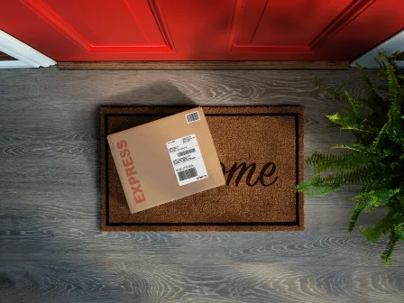
You own a pizza chain and your delivery driver receives a delivery order for 606 W 1720 N Building 2 Apt 5 Provo, UT 84606. They put the address into Google Maps and 5 minutes later, they are pulling up to a large apartment complex.
There are 10 dismally marked buildings and Google has routed them to the pool. Wonderful, exactly where they need to be and 15 minutes later they've finally delivered cold pizza to your customer. I'm sure the review wasn't kind, so let's see how Smarty's Rooftop Geocoding product turns scenarios like these around.
Using Smarty's API your driver receives a location bubble marking the exact building and exact location of the apartment on the building. What this means is that on building 10 Smarty will mark which corner or side of the building apartment 5 is located.
Now your driver delivers the warm pizza to a happy customer, gets a larger tip and is back to the office all in 15 minutes and ready for another delivery. More pizzas delivered in less time? Awesome! Plus, better customer reviews. Even better!
Okay, that's cool, but my business doesn't deliver pizza, we deliver packages and need to create delivery routes. Can Smarty's geocodes help?
Shipping
Yes! Let's take Ecommerce as our example this time:
An ecommerce business receives 66 thousand orders an hour and each address associated with those orders needs to be verified as deliverable. Easy, Smarty's got you covered just like the pizza guy, but let's say that a major ecommerce business wants to map each of those addresses to create the most efficient delivery routes for each driver.
First, the retailer will verify each address with Smarty and receive its rooftop-accurate latitude and longitude coordinates. Once the houses have been mapped, the business can draw up the most efficient delivery route for each driver. This saves the company gas, employee time, and delivery costs of inaccurate addresses.
Who knew latitude and longitude could help with delivery routes! This is so cool, but how can Smarty's geocodes help me if I'm not in shipping or delivery, but insurance?
Insurance
As the CTO of an insurance company, you're pioneering the use of hyper-accurate rooftop geocodes to enhance your risk assessment and underwriting process. This technology allows you to pinpoint a building's exact location and proximity to hazards, refining your traditionally broad geographic risk evaluations.
For instance, you've improved your flood risk assessment by considering a property's specific elevation and location rather than just the general flood-prone region. It's similar with wildfire risks, where you now consider proximity to particular vegetation types instead of the entire ZIP Code area.
This granular approach reduces your overall exposure and leads to more accurate premiums. Lower-risk buildings get lower premiums, and vice versa, reflecting individual property risks better than the competition. The precision also helps in fraud detection, as you can cross-verify property details and ensure claims are legitimate.
The result is a significant cut in operational costs and reduced liabilities. It's not only about cost-saving but also about gaining your customers' trust by providing them with premiums that truly match their property risks. True rooftop geocoding reshapes how you approach insurance underwriting.
So yes, even insurance companies can benefit from using geocodes in their day to day processes.
Conclusion
There are many ways to use latitude and longitude coordinates; it just depends on your unique use case. For now, we've learned that six-decimal latitude/longitude coordinates provide the resolution you need.
By adding accuracy and precision to the discussion, we covered why it's a major part of where your location pin lands, how useful it is, and how it can save your company time and money.
For more information, try our US Rooftop Geocoding demo or international geocoding demo built into our International Address Verification product. Then, sign up for a free trial.